


By Yunus S. Saliu
The Gambia-Senegal boundary demarcation exercise has progressed to its second phase following the completion of the first phase of fieldwork, which covered nearly 30 kilometres, with the joint technical team identifying several colonial-era boundary pillars.
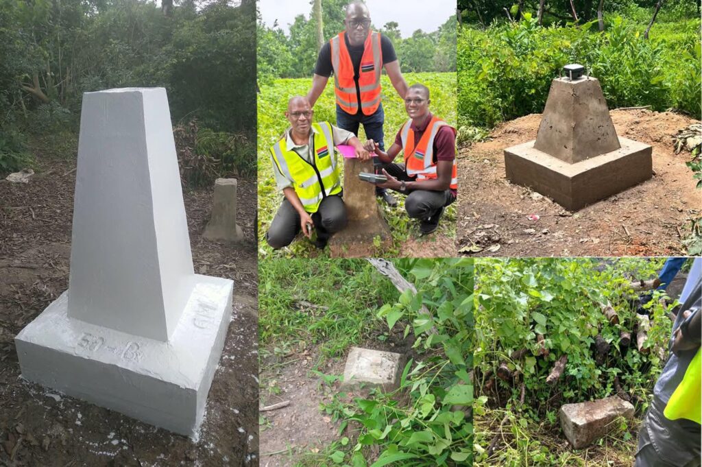
The Director General of the National Centre for Arts and Culture (NCAC), Hassoum Ceesay, said the team had discovered colonial boundary pillars at Mbalgoh, Njau, Kerr Moteh Ali and Pancha Ngama during the ongoing second phase.
Mr Ceesay, a member of the boundary demarcation task force, said historical records and colonial maps preserved in the NCAC archives had proved valuable in guiding the technical team as it worked to clarify and document the international boundary between the two neighbouring countries.
He said the exercise was progressing smoothly, with communities along the border cooperating with and supporting the process. Sensitisation activities conducted by a separate team were also progressing well, helping residents understand the exercise and its importance.
The development follows the completion of the first phase of fieldwork, which covered nearly 30 kilometres from Dimbaya in Kombo to Kanao in Foni.
During six weeks of fieldwork, the joint Gambia-Senegal Boundary Commission team reaffirmed existing colonial boundary pillars, recorded geographical coordinates and installed new pillars to make the international boundary clearer and easier to identify.
At the end of the first phase, the joint team signed nine agreements covering various technical aspects of the exercise. Representatives of both countries signed the agreements, which were witnessed by the Permanent Senegal-Gambia Secretariat and experts from Ghana and Burkina Faso.
According to Mr Ceesay, the agreements include joint reports on densification points, coordinates and boundary pillars, among other technical matters. Each reaffirmed colonial boundary pillar will have a descriptive sheet, while newly installed pillars will also be supported by detailed documentation.
He stressed that the exercise went beyond surveying and installing boundary markers, involving historical verification and the systematic preservation of records to ensure transparency, technical credibility and future reference.
Historical records preserved at the NCAC indicate that the boundary between The Gambia and Senegal was originally demarcated between 1889 and 1905 under British and French colonial administrations, a process that took 17 years.
Mr Ceesay explained that the unusual shape of The Gambia largely resulted from an agreement between the two colonial powers under which Britain retained a narrow corridor along the River Gambia, while France controlled the surrounding territory.
The original demarcation relied heavily on natural and temporary landmarks, including trees, ponds, bolongs and footpaths. These markers proved unreliable, however, as trees were uprooted by storms and ponds dried up, prompting the colonial authorities to introduce permanent concrete boundary pillars between 1904 and 1905.
In a separate update, Mr Ceesay highlighted historical measures adopted to protect the pillars from damage. He said they were fenced with wire mesh or strong wooden logs to prevent cattle and other animals from damaging them and to make them easier to identify.
He said the national budget provided D100 for boundary pillar protection until 1985, with the allocation channelled through district chiefs and, in some cases, area councils responsible for overseeing the maintenance of the markers.
According to him, the allocation was discontinued in 1985 during the introduction of the Economic Recovery Programme, following an economic crisis that prompted government spending cuts.
Mr Ceesay said the loss of the allocation affected efforts to protect the boundary pillars, underscoring the need to renew attention to their preservation as The Gambia works to strengthen the integrity of its national boundary.
He also explained that the current exercise involved densification, the installation of additional pillars between identified colonial boundary markers to make the boundary easier to locate and follow.
Other cases documented during the exercise include an uprooted colonial pillar whose base was found near Duassu, a pillar base without its original marker near Sohm, and a newly constructed pillar placed beside an existing colonial pillar at Dimbaya to improve identification.
The joint demarcation exercise is expected to establish a clearer, properly documented and mutually accepted boundary between The Gambia and Senegal, helping to prevent misunderstandings while promoting peace, stability, social cohesion and good neighbourliness.
Mr Ceesay said the documentation and agreements produced through the process would be preserved for posterity, ensuring that the work of the joint technical team remained available for future reference.